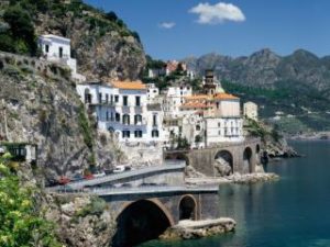
Amalfi is located along the river valley Canneto (or clarified as it was once called) held between Monte Aureo in the East and Mount Tabor to the west, the town center has the shape of an upside-down fan that measures approximately 1.5 km in the most wide, on the beach, and a few hundred meters in the section opposite the Valley of the Mills (about 2 miles inland). The aforementioned Valley is the urban part of the wider Valle delle Ferriere, the old “industrial area” of Amalfi, where stood the mills and the old ironworks from which its name to the district. The Valley for its peculiarities faunal and environmental nature reserve is now oriented, and will be a destination for a pleasant walk. Outside the city center, in a westerly direction and parallel to Highway 163, runs the ancient Via Maestra Villages. Surrounded by green terraces of lemons and olive trees along the entire length, about 4 km, is the ancient pedestrian road linking the center of the 5 fractions of Amalfi. On the seaward side the other hand, always westward winds the picturesque coastline full of beautiful gorges, beaches and in the last of the beautiful Emerald Grotto. Eastwards the other hand, a few hundred meters is Atrani, reachable by taking the SS 163 which the panoramic pedestrian street S. Maria of the Lord, that we’re going to go. Given the breadth of the territory then, to make it easy, but at the same time complete, the visit of the town and the immediate surroundings, we come to offer paths ideal for leisurely walks, marked with different colors, as they run through the territory , leave to embrace the monuments, landscape, historical and cultural …


